BioBase Applications benefiting conservation of UK’s Wetlands

Fisheries Scientist Jim Lyons from the UK’s Environment Agency has been in action over the last few months introducing Yorkshire Fisheries Officers to the benefits of the BioBase system. Following two days of survey work on a couple of gravel pit fisheries in the area the team received a report less than a week later.  Mike Lee from the local team and the angling clubs who manage the waters, were very impressed with the technique and the report generated. They have come away with a host of ideas about how to further use Lowrance Fish Finders and the Biobase System across their catchment in both river and Stillwater fisheries.

Further Mr. Lyons, recently presented to aquatic plant specialists from the Environment Agency, Natural England and Natural Resources Wales at Preston Montford Field Studies centre as part of the relaunch of the aquatic plant specialist’s network.

Area specialist are responsible for the technical lead for aquatic plant survey delivery within their Area, ensuring that all aquatic plant surveyors are suitably trained and have the relevant support to deliver their surveys. The specialists also play a key role in underpinning the delivery of the quality assurance programme.

Mr. Lyons talked about ‘Using acoustics and cloud-based technology to monitor aquatic weed.’ He shared with the group the benefits of using BioBase to inform weed management programmes. Enthusiastic feedback from the group has provided a number of potential new applications for this technology from across the Department of Environment, Food, and Rural Affairs (DEFRA) family organisations present.

BioBaseSurveyShelteredLagoon

20191022 LWC19 BV Heatmap
Density of aquatic vegetation (% Biovolume) in Sheltered Lagoon, London Area UK.

BioBase Paper Published: Accuracy and Precision of Low-Cost Echosounder and Automated Data Processing Software for Habitat Mapping in a Large River

We are grateful to the aquatic research community who continue to verify and validate Consumer Sonar Technologies (Lowrance) and BioBase automated mapping platform to produce scientifically valid outputs that benefit aquatic conservation.  We are excited to see the recent publication of research out of the University of New Brunswick that evaluated the accuracy and precision of Lowrance and BioBase’s EcoSound depth and vegetation outputs.  The research is published in the open access journal Diversity and can be downloaded here. Below is the abstract

Abstract
The development of consumer hydroacoustic systems continues to advance, enabling the use of low-cost methods for professional mapping purposes. Information describing habitat characteristics produced with a combination of low-cost commercial echosounder (Lowrance HDS) and a cloud-based automated data processing tool (BioBase EcoSound) was tested. The combination frequently underestimated water depth, with a mean absolute error of 0.17 ± 0.13 m (avg ± 1SD). The average EcoSound bottom hardness value was high (0.37–0.5) for all the substrate types found in the study area and could not be used to differentiate between the substrate size classes that varied from silt to bedrock. Overall, the bottom hardness value is not informative in an alluvial river bed setting where the majority of the substrate is composed of hard sands, gravels, and stones. EcoSound separated vegetation presence/absence with 85–100% accuracy and assigned vegetation height (EcoSound biovolume) correctly in 55% of instances but often overestimated it in other instances. It was most accurate when the vegetation canopy was ≤25% or >75% of the water column. Overall, as a low-cost, easy-to-use application EcoSound offers rapid data collection and allows users with no specialized skill requirements to make more detailed bathymetry and vegetation maps than those typically available for many rivers, lakes, and estuaries.

EcoSound vs Manual Measures Vegetation Helminen et al 2019

Networking 3rd Party GPS/GNSS into Lowrance

Ray Valley

Aquatic Biologist and BioBase Product Expert

I frequently get inquiries from current and prospective BioBase users about the accuracy of consumer-grade Lowrance GPS and whether survey-grade 3rd party receivers capable of differential correction (DGPS) or receiving positions from multiple satellite constellations (Global Navigation Satellite System – GNSS) could be used with Lowrance and processed with BioBase.

The first question about accuracy prompted a test in March of 2013 with a Lowrance HDS tested side-by-side with a Trimble GeoXH.  I was pleased to find less than 1m deviation on average from post-processed Trimble DGPS positions.  One meter accuracy and precision is typically sufficient for most boat-based mapping applications. Still, prerequisites for some projects require DGPS, and there are a number of BioBase users who have and still would prefer to have DGPS generated positions to use when logging trips. Thus, I was interested in exploring the capabilities of networking positions from a third-party receiver into a Lowrance HDS.

Continue reading “Networking 3rd Party GPS/GNSS into Lowrance”

BioBase is now Metric compatible!

Ok. It’s long overdue. But, better late than never! Much to the delight of non-US users, now you can choose whether BioBase EcoSound outputs are in metric or imperial units.

AccountPage_Screenshot
Click on “My Account” to select the desired units.
ShobyLake
Metric output contoured in 0.5 m intervals. Contour detail is autodecluttered based on your zoom level in BioBase.

Wish to change units of an already processed map?

If you processed a trip with one unit setting and wish to recontour the map in a different unit, simply change the unit in our Account Profile and then go back to the trip of interest and reprocess

TripReprocessing
After selecting a new unit, reprocess the map to contour in the new units

Helpful Resources for Getting Started with BioBase’s EcoSound

BioBase is a powerful data collection and mapping tool for aquatic environments. To get the best results with BioBase – EcoSound, it is important to use proper hardware installation and data collection procedures. This post contains links to the resources that will help you get started with BioBase and get great data.

First, BioBase is only compatible with Lowrance and Simrad Sounders/Chartplotters. This blog offers helpful advice for which sonar to choose

Our quality control team reviews every uploaded trip and looks for glaring issues with the trip like evidence of a slanted transducer, signal loss, or poor signal quality. Its critically important that you have your transducer installed correctly. We recommend you take it to marina to have it professionally installed.

Our Quality Control Team may email you if they notice any significant issues with your trip, and suggest ways to fix the issue or ways to improve data quality before logging again. Waterbody boundary adjustment is part of the BioBase service but there will be a delay between when your trip is automatically processed and when Quality Control staff are able to adjust the boundary of your waterbody. Please allow one business day for quality control before finalizing or sharing your maps, or check the quality control review status by viewing a trip’s report.

OrchardVegReportQC

If there is a quality control reviewer’s name on the report with comments, the trip has been reviewed. You can also see any comments that were not emailed to you on the report.

It is also important to keep your Lowrance software updated. Software updates can be found here. Outdated software can result in inaccurate or lost data!

Our YouTube channel has many helpful videos, including data editing tutorials.

This post gives an overview on how EcoSound works along with some answers to frequently asked questions that many new users have.

The EcoSound Quick Start Guide shows recommended settings to use while logging sonar. Print this guide and keep it on your survey boat.

The EcoSound Support and Resources page has links to the EcoSound Full Operator’s Guide as well as several tutorials, including guides for using EcoSound data in QGIS.

If you ever need any assistance, contact the BioBase support team at info.biobase@navico.com

Helpful Lowrance Hints: Depth Tracking

We promote BioBase as an automated “easy-button” solution for creating aquatic maps, but unfortunately, mobile acoustic data collection is not something you can push a button and forget about and expect perfect results.  Like using most other sophisticated instrumentation, users need to monitor that the instruments are performing as expected and sometimes make adjustments if they aren’t.

Continue reading “Helpful Lowrance Hints: Depth Tracking”

ciBioBase Vegetation Mapping

We love to show off the accuracy of our submerged vegetation mapping algorithm.  Check out this break in the weeds that was picked up and clearly displayed in the ciBioBase vegetation layer:

The BioBase vegetation layer is automatically generated by powerful cloud computers so you receive an objective output every time.  The white line on the right and red dot on the left show the boat position as a cross section and aerial view of the water column respectively. 

Submerged vegetation is displayed as percent biovolume (BV%) which represents the percent of the water column occupied by plants.  This provides a clear picture of total plant abundance from each trip on the water.  Data can be passively logged because none of our users have to do any of the processing when they get back to the office.  Do what you were already planning to do and our automated system will take care of the rest.

Let us know if you have any questions about how this process works!

Guest Blog: Using BioBase to determine sedimentation in the Central Arizona Project canal

by Scott Bryan

The Central Arizona Project (CAP) is a multipurpose water resource development and management project that provides irrigation, municipal and industrial water to much of Arizona.  The primary means of water conveyance is a 336-mile concrete-lined aqueduct that transports water from the Colorado River, on Arizona’s western border, across the State to Phoenix, and then southward to the aqueduct terminus near Tucson.  Each year, over 1.5 million acre-feet of water is delivered to our customers.

Since its completion in 1993, the aqueduct system has experienced increasingly severe sedimentation that creates problems within the pumping plants and in the aqueduct itself.  Because the sediments can decrease the flow capacity of the aqueduct, cause damage to pumps and internal systems, and restrict flow through critical filtration units, it is imperative that dredging operations occur periodically.

sedimentation, ciBioBase, water volume, depth, mapping, bathymetry
CAP forebay dredging in 2009

In the past, CAP performed intensive sonar based sediment studies to determine bathymetry and the amount of deposition in the forebay of each of the 13 pumping plants.  The surveys show when and where dredging operations should occur.  These surveys were contracted to outside companies with costs ranging from $40,000 to $120,000 annually.

In 2012, CAP began to use the sonar technology provided by BioBase to conduct its own bathymetry surveys in the pumping plant forebays.  Water depths are compared to historical baseline surveys and the volume of sediment in each forebay can easily be calculated.  Annual surveys allow us to compare sedimentation from year-to-year to determine loading rates and critical areas to target sediment removal.  Surveys of all 13 forebays can now be accomplished in three days rather than six months, and when compared to the expensive surveys from the past, are equally as accurate.

ciBioBase, bathymetry, water volume, depth, Lowrance, acoustics, mapping, sonar, sedimentation, dredging
Blue-scale bathymetric map of a CAP forebay.  The light blue contours show an area that is extremely shallow and is in need of sediment removal.


ciBioBase, sedimentation, Lowrance, downscan, sonar, mapping, bathymetry, depth, water volume
Example transect design and resultant bathymetric map coupled with the sonar log viewer.  Notice the detailed image of the forebay’s trash racks produced by Lowrance HDS DownScan
This new approach to bathymetric and sedimentation mapping saves time and money, allows us to evaluate results immediately, and makes dredging operations more efficient and timely.

Scott Bryan is the Senior Biologist for Central Arizona Project (CAP).  After receiving an M.S. in Fisheries Management at South Dakota State University, Scott worked as a research biologist for Arizona Game and Fish for 10 years, then specialized in lake and stream management for seven years at a private consulting firm in Albuquerque.  Scott’s current position at CAP includes a broad scope of work, including aquatic and terrestrial vegetation control, fisheries and wildlife management, invasive species research, and water quality monitoring.

GPS Accuracy Test of Lowrance HDS


At BioBase we put Lowrance HDS to the test for GPS precision and accuracy.  We know the importance of accurate maps but also recognize that “consumer-off-the-shelf” doesn’t mean it won’t provide the type of accuracy needed for accurate acoustic mapping.  The question lies more in how precisely accurate we can map aquatic environments with a “survey-grade” versus consumer GPS.  There are a lot of considerations when mapping from the surface of a water body.  Not only the accuracy of the GPS signal itself but the movement of a survey vessel on a liquid surface, wind, number of points surveyed, survey design, depth, acoustic cone degree, etc.  The list goes on because plants grow, you’re usually in a boat and water moves.  But, we can still investigate the precision of the WAAS corrected GPS from Lowrance HDS.  We were happy with our test results . . . but not surprised!

Units Tested:
  • Trimble GeoXH 6000 Series (post processing DGPS correction to 12” accuracy and precision)
  • Lowrance HDS-5 (WAAS-Correction Enabled)
  • Lowrance HDS-7 Gen2Touch (WAAS-Correction Enabled)
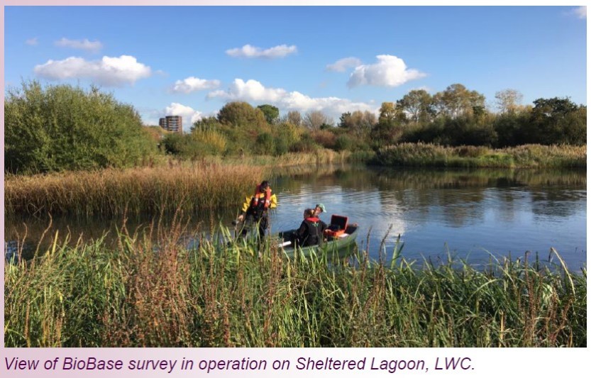
 

Methods:
  • Two individuals recording tracks while walking in same footprints, units held at chest level
  • One individual recorded a track with the Trimble Unit while the other held the HDS
  • Process repeated with the Trimble and HDS7 Touch
  • Data collected in a 2-acre soccer field in Minneapolis surrounded by trees
  • GPS Track lines from both units were uploaded to ArcGIS and converted to points
  • Point layers from both units were spatially joined and distance from each HDS track point to the nearest Trimble GPS track point was calculated
  • Conditions: Clear skies and HDOP (Horizontal Dilution of Precision) was less than 3
  • Testing Completed March 14, 2013


One glaring item that can be pulled from the chart above is the accuracy of the Trimble unit before DGPS correction.  Published accuracy is much different than actual accuracy.  You can see from the numbers above that the DGPS correction didn’t adjust the Trimble track by much. When compared against the static HDS output, the comparison hardly changes (from an average difference of .71m between the HDS7 Touch and Trimble™ DGPS before correction to .69m after correction and .45m to .83 respectively for the HDS5).  Even after DGPS correction, both HDS units performed extremely well with significantly less than 1m average difference between tracks (.69m for HDS7 Touch and .83 for the HDS5).
At Contour Innovations we’re focused on best and uniform geostatistical models, acoustic processing, number of data points, and other key standard operating/data collection procedures to create good maps.  The average difference shown in the chart above could even be significantly less than the size of your acoustic cone (depending on cone angle and depth).  Spacing of your sample points is also very important.  The Lowrance HDS system records up to 20 pings per second.  The precision and accuracy of a map created from such voluminous data sets is unmatched.  When analyzing this much data during your survey the geostatistical model and spatial references are substantially improved.


Geo-statistical algorithms:  No acoustic map is made up of a complete data set.  Data sampling points with less that 100% coverage still require a statistical model of extrapolation or interpolating of neighborhood points.  All aquatic maps are created with some level of geo-statistical model like kriging.  Ensuring accuracy of actual points will help decrease error coefficients of estimated data but more important is the type of geo-statistical model and spacing between data sampling sights.  There is a positive correlation of error coefficient and transect spacing.  We recommend transect spacing of less than 50m and even higher resolution and lower spacing depending on mapping objectives.


Geostatistics is a branch of statisticsfocusing on spatial datasets originally developed to predict probability distributions.  A number of simpler interpolation methods/algorithms, such as inverse distance weighting, bilinear interpolation and nearest-neighbor interpolation, were already well known before geostatistics, but it goes beyond the interpolation problem.  Kriging, the model we use, is a group of geostatistical techniques used to interpolate the value at an unobserved location from observations of its value at nearby locations.  This means that as you collect data along a transect, those data can be used to predict unobserved data between points to a statistically significant probability.  A good geostatistical model and the number of sample point are key to a complete and accuracy map!
A couple things to consider that could influence the accuracy and precision of your maps:
  • Pitch, Roll and Yaw – Wave action or other movements of the boat as you take a physical samples
  • Tree Cover – which isn’t as common when mapping open water like lakes
  • Relation of GPS antennae to transducer – Even with 12 inch DGPS accuracy, if you’re standing 3 feet from your transducer your data points will be off.  If you take a core sample and enter the results into a GPS device, your boat could easily have drifted a lot more than your potential error.   With Lowrance HDS we provide an external antennae that can be mounted directly above your transducer so your data collection is happening at the point spot of your GPS signal.
  • Overall Survey Design – The spacing of your transects is key as it relates to the ability to confidently make predictions in unsampled locations with your geo-statistical model. 
  • Speed of Travel – When looking at a wide range of data collection techniques and methods, speed is always the biggest consideration for accuracy and coverage.


“Published Accuracy” is much different than actual accuracy.  A lot of this is a guarantee from the manufacturer to be less than a certain error threshold at least 60% of the time and is not a minimum.
Because of this, there’s an opportunity to use scare tactics to discount the power of an off-the-shelf acoustic unit or GPS.  But, as we’ve described here, there’s a lot that goes into making a map!
We were very impressed with the performance of the WAAS corrected Lowrance™ HDS when compared against a system like the differentially corrected Trimble™ unit.  Though, we can’t say we’re surprised!
For more information on getting the best and most accuracy maps please contact one of our fisheries biologists and GIS experts.
Lowrance™ and Trimble™ are registered trademarks of Navico, Inc. and Trimble Navigation Limited respectively.  Neither Company contributed, authorized, or requested this testing.       

Crowd Sourcing Lake Mapping

Natural Resource Managers and Climatologists have long recognized the critical importance of observer networks and volunteer citizen monitoring.   With citizen monitoring networks, Managers and Scientists acquire useful data for making more informed predictions and management decisions, while involved citizens gain an ownership stake in building the knowledgebase about the condition of ecosystems and the climate.

Citizen protocols for water quality (e.g., Secchi clarity) and meteorology (e.g., rainfall) data collection are largely objective and are becoming increasingly standardized throughout the nation.  As a result, comprehensive datasets are being merged at large geographic scales to assess the current status and trajectory of water resource and climate conditions.  Despite well-intentioned citizen programs to map and monitor aquatic plants in several US states, most are subjective and non-standardized.  Consequently, results will differ across surveyors, systems, and geographic regions.  This strongly limits the power and usefulness of data collected from these programs.   This is unfortunate because of the importance of aquatic plants for fish habitat and water clarity, and the vulnerability of lakes to invasive aquatic plants.

Contour Innovations has addressed this issue with ciBioBase and is poised to revolutionize citizen aquatic plant monitoring.

Objective data collection and analysis

Few others cover more water than citizens living on lakes.  Why not capture information about bottom conditions while on a pleasure cruise or fishing?  With only a modicum of planning, the lake could be divvied up among users to ensure consistent and uniform coverage.  By loading in a $10 SD card into the slot on a Lowrance HDS unit and hitting record while driving over areas of interest, lake citizens are well on their way to collecting important information on aquatic plant growth.  After a trip, citizens upload the recorded files to ciBioBase’s cloud-based servers which will trigger algorithms to automatically analyze bottom and plant signals, map the output and match it up with your sonar viewer (Figure 1).  Pretty maps? Absolutely! But also, objective statistical reports that summarize the plant growth conditions (e.g., percent cover, biovolume; Figure 2).  By sampling the same area over time, citizens can objectively monitor change as environmental conditions change.  Further, these efforts will provide objective benchmarks by which to evaluate watershed, shoreline, and in-lake management efforts. 
Figure 1. Automated mapping of bottom and vegetation signals matched up a high resolution DownScan sonar trip replay. 
Figure 2. Excerpt from ciBioBase automated statistical summary report.


Data that most closely corresponds to water quality, fish habitat, and nuisance conditions


Prior to ciBioBase, lake citizens, service providers, and natural resource agencies had little choice but to express plant growth in the lake as “abundant” or “sparse” with sophistication ranging up to digitally drawn maps around the outside of plant beds that they could see from looking over the side of the boat or from an aerial photo.  Anything that could not be seen with the naked eye or from an aerial photograph was ignored.  Quantification was limited to what could be pulled up with a rake and expressed as a presence/absence  metric of frequency of occurrence.
From a water quality and fish habitat perspective, these methods have left the fishery and water resource manager, lakeshore owner, and angler wanting.  Traditional plant assessment methods as described would give the same value to the strikingly contrasting environments depicted in Figure 3).  In the panel on the left, plants only occupy approximately 60% of the water column.  There are adequate hiding places for prey and room for predators to swim around in search of prey.  Plants are adequate to anchor sediments and prevent stirring of sediments that can make the lake murky.  Last but not least, a boat can easily pass through without disturbing the habitat.  Contrast this with the panel on the right.  Although the visual delineation or rake throw prescribed by traditionalists would give the same information on density as the panel on the left, fish habitat and water recreation conditions are strikingly different between the two environments.  In this simulated invasive aquatic plant community (e.g., Eurasian watermilfoil or Hydrilla) without any edge, predatory fish have difficulty finding prey, boat propellers are stopped in their tracks and outboard impellers imperiled!  Essentially, the differences described between the environments in Figure 3 can be summarized in the ciBioBase biovolume maps and statistical outputs.  Ask your service provider or local water resource manager how they measure aquatic plant growth conditions in your favorite lake and evaluate whether they stack up to what ciBioBase provides.
Figure 3.  Contrasting aquatic plant environments that are often represented equally in traditional assessment methods.  On the left is growth that typifies a diverse, native aquatic plant community as opposed to topped-out growth that typifies invasive plant communities.  By mapping biovolume (percent of water column occupied by vegetaton), ciBioBase distinguishes the differences between these plant communities.
Centralized database – Apples to Apples

All data uploaded to ciBioBase are processed uniformly in a centralized database and made available to subscribers in a private organizational account.  Data from Lake Minnetonka in Minnesota can be compared with data from East Lake Tohopekaliga in Florida or data from Esthwaite Water in the UK and comparisons will be apples to apples.  The centralization feature of ciBioBase comes with these tangible benefits as well as intangible ones like fostering greater collaboration between groups interested in aquatic resource conservation.
Merged uniform outputs from multiple surveyors

A new buzzword has been entering the vernacular of natural resource managers called “precision conservation” brought on by advances in aerial photography, lasers (LiDAR), automated sensors, and greater computing power.  We can now identify miniscule areas on the landscape that are sources of runoff and pollution and strategically target those areas to install “Best Management Practices” or BMP’s like rain gardens or grit chambers.  However, thus far the dialog surrounding precision conservation has largely been terrestrial.  ciBioBase is bringing precision conservation to lakes through its merge trips function (Figure 4).
As ciBioBase account managers our users can compile trips from subscribers within their  organization to create a highly precise map of bottom and vegetation (Figure 4).  This division of labor describes the essence of this blog’s title whereby the collective efforts or intelligence of the many are more powerful than any one individual.  No one person is willing or able to track how the lake is changing from day to day as runoff from an increasingly common 4-in rain comes streaming (literally) in, but a dozen active citizens might.  The result is a near real-time data feed on changes in lake conditions that will greatly inform how the lake responds to environmental change, where to target conservation efforts, and whether implemented management policies are producing their desired effects.
Figure 4. Multiple citizens in the same organization can work together by merging trips, thereby creating the most accurate bottom and plant map on the face of the planet!
Translate »
%d bloggers like this: