
Given the disdain for the word “weed,” it’s not surprising that seaweed gets such little respect in most developed human cultures. But, we are finding seaweed and its rooted cousin seagrass hold immeasurable value for the future of humankind. Time to get to work mapping it!
Seagrasses are considered vascular plants and have roots, stems, leaves, and flowers. According to a report from the United Nations in 2020, there are more than 70 species across the globe covering over 300,000 km2 (which is likely a vast underestimate) making them one of the most widespread coastal habitats.
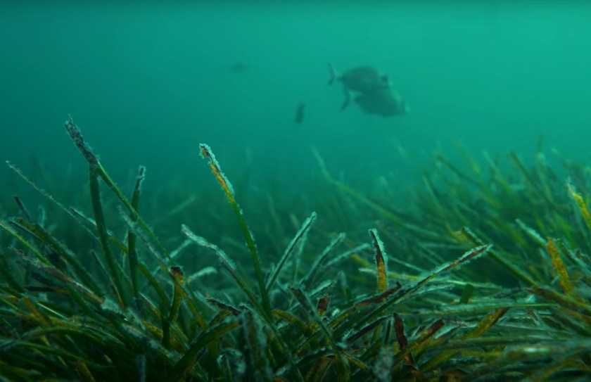
In contrast, seaweeds are multi-cellular algae and have little or no vascular tissues. According to Wikipedia, species are varied and number into the thousands. Global estimates of seaweeds are even less reliable than seagrass and Jayathilake and Costello (2020), estimated that kelp occupied an area of almost 1.5 million km2; approximately 22% of the worlds coastline. Seaweeds fall into one of three main categories: Red, Brown, and Green. Kelp is a very common type of brown seaweed species that is driving growth in the multi-faceted seaweed cultivation industry.

In addition to human uses, both seaweeds and seagrasses have a myriad of other ecosystem benefits including habitat and food for for fish and marine mammals, pollutant filtration, anchoring coastal shorelines and protecting against erosion, sequestration of carbon and acid-base balance of the ocean.
A growing seagrass industry
The seaweed industry is big and has been growing rapidly. According to a report by Allied Market Research, the global seaweed market size was valued at $6.5 billion in 2021, and it is projected to reach $14.6 billion by 2031. Little do people know that seaweed is used in toothpastes, shampoos, salad dressings, puddings, cakes, dairy products, frozen foods, animal feed, biofuels, cosmetics, fertilizers, distilled spirits and fermentation, immunity enhancement, cancer treatment, and natural hormonal therapy. As such, there is growing efforts by industry to cultivate seaweeds in addition to harvesting wild stands. However, seaweed farming remains niche with just over 30 producers in the US and small farms in Coastal Asia producing 32.4 million dry tons mostly for human consumption in 2018 (Hauke et al. 2022). The beauty of kelp farming is that it doesn’t require arable land or water inputs or even seabottom. Kelp grows on man-made rope! Wild kelp harvest is also practiced by a small number of commercial operators growth of the industry is hindered by the lack of quantitative knowledge about the extent of growth and levels of sustainable harvest.
Carbon sequestration
A little known fact is that seaweeds and seagrass absorb and sequester some serious CO2 from the atmosphere. They are key potential contributors to a global “Blue Economy”
Fourqurean et al. (2012) report an absorption rate of seagrasses 35 times faster than tropical rainforests; storing up to 83,000 metric tons of carbon per square kilometer, which is more than twice the amount stored by the world’s temperate and tropical forests. Seagrasses also serve as reversing agents of ocean acidification (who has ever heard of alkalification?).
Threats to seaweed and seagrass
Seagrasses in particular have received special attention by the United Nations. In 2020, they published a 95 page report entitled “Out of the blue: the value of seagrasses to the environment and to people.” This report cites a 30% loss of the world’s seagrass beds since the late 1800’s due to urban, industrial and agricultural run-off, coastal development, dredging, unregulated fishing, scarring due to boat props and anchors, and climate change. The report goes on to suggest 13 recommended actions including developing a comprehensive global map of seagrass distribution and health and ramping up citizen science efforts to aid in data collection while engaging citizens and broadening ownership in seagrass conservation. This is where BioBase comes in.
BioBase to the Rescue!
On page 48 of the Out of the Blue report cites that “[t]here are many challenges when mapping seagrasses globally. According to the best available knowledge, seagrasses occupy over 300,000 km2 of seabed – an area equivalent to
the size of Germany – distributed in all continents except Antarctica. However, this information is based on an amalgamation of diverse data sets, including field data measurements (points), remotely sensed measurements (often polygons) and expert knowledge collected over varying spatial scales between 1934 and 2015. The nature of the information and its large temporal variation could result in a possible underestimation of the global area covered by seagrasses.”
BioBase’s EcoSound – using consumer sonar and automated cloud mapping of seagrass and seaweed
Established in 2011, BioBase has grown into the industry standard method for automated mapping of aquatic plant abundance with acoustics; specifically Lowrance and Simrad branded sonars. Several scientific publications demonstrate BioBase’s utility for mapping freshwater aquatic plants, especially invasive species. Somewhat surprisingly given the importance of seagrass, coastal seagrass and seaweed mapping programs are far fewer and less funded than inland programs focused on freshwater invasive aquatic plants. Thus, BioBase use for seaweed and seagrass program remains niche but bursting with potential for future adoption. Dr. Chris Harrod’s recent research on Chilean Kelp dynamics represents the best demonstration of BioBase for mapping of kelp (Figure 1).


On a special trip to the Tabarca Marine Reserve, we demonstrated how to use Simrad Evo sonar technology, autopilot mapping, and BioBase to map critical Posidonia seagrass habitats around the popular island near Alicante, Spain
Promise for Citizen Science
On page 58 of the Out of the Blue report is a special section on the potential of Citizen Science to support seagrass management and conservation. C-MAP has a popular cloud crowd-sourced mapping service called C-MAP Genesis (genesismaps.com) whereby thousands of anglers annually upload their sonar logs and create custom private and shared “social” maps for fishing. In 2021, anglers uploaded over 2 million acres and have uploaded over 30 million acres since 2012 much of which can be seen on genesismaps.com/socialmap. Our database stores information about depth, aquatic vegetation abundance, bottom hardness, surface water temperature. As part of the Navico Group’s Sustainability Mission, we share these crowd-sourced data with researchers (contact us to learn more)
Any citizen, commercial operator or untrained Biologist with a properly installed Lowrance or Simrad depth finder coupled with BioBase EcoSound processing can collect high quality, very detailed data on not only coverage of seagrass and seaweed, but also canopy height. Thus, standing stock, sustainable harvest models, marine protected area and restoration area monitoring can all be done with little formal training in hydroacoustics and hydrographic modeling. This represents a huge step forward in the user friendliness of sonar and cloud technology that has not yet been widely recognized in standard seagrass assessment protocols and groups providing toolkits to researchers.
Through citizen science, we can directly address the second recommended action of the Out of the Blue Report: “Develop a comprehensive global map of seagrass distribution and health. Includes standardized data collection that is cost-effective, accurate and can be shared.” Cost-effective, accurate, and can be shared are the foundations of the BioBase technology!
How to get started with BioBase
Contact Sales@biobasemaps.com there are a range of subscription options that could fit your budget. Further, if you are a field researcher, it’s highly likely you already have a depth finder on your boat. If it’s a Lowrance or Simrad, you are ready to record, upload and analyze data right now!